
 Call Us or Whatsapp 9779808220612
 Email Us [email protected]
- English [EN]
- Espanol [ESP]
- France [FR]
- Deutsch [DE]
- China [CN]
- Japan [JP]
- Arabic [AR]
- Hindi [HI]

Langtang Valley Short Trek
 Duration: 9 Days
 Difficulty: Moderate
 Accomodation: Hotel/ Lodge/ Teahouse
 Meal: B-L-D
 Max. Altitude: 4,773 m
 Best Seasons: Spring (March-April-May) & Autumn (Sep-Oct-Nov)
Langtang Valley Short Trek
The Langtang Valley Short Trek is one of the most rewarding Himalayan journeys that can be completed within a relatively short time from Kathmandu. The route begins in the lower forests around Syabrubesi and gradually climbs through the Langtang Valley to Kyanjin Gompa at 3,870 m, before reaching the trek’s highest point at Kyanjin Ri at 4,773 m.
Although the Langtang region lies much closer to Kathmandu than many of Nepal’s major trekking areas, the scenery quickly feels remote once you leave the road behind. From Syabrubesi, the trail follows the Langtang Khola through a deep river valley covered with bamboo, oak, rhododendron, pine and other mountain forest.

The first days are spent largely beneath the trees, crossing suspension bridges and climbing gradually through the lower valley toward Lama Hotel. Wildlife is rarely predictable, but the surrounding forests form part of Langtang National Park, an important protected habitat for species such as the red panda, musk deer, Himalayan black bear, Himalayan tahr, ghoral, serow and snow leopard.
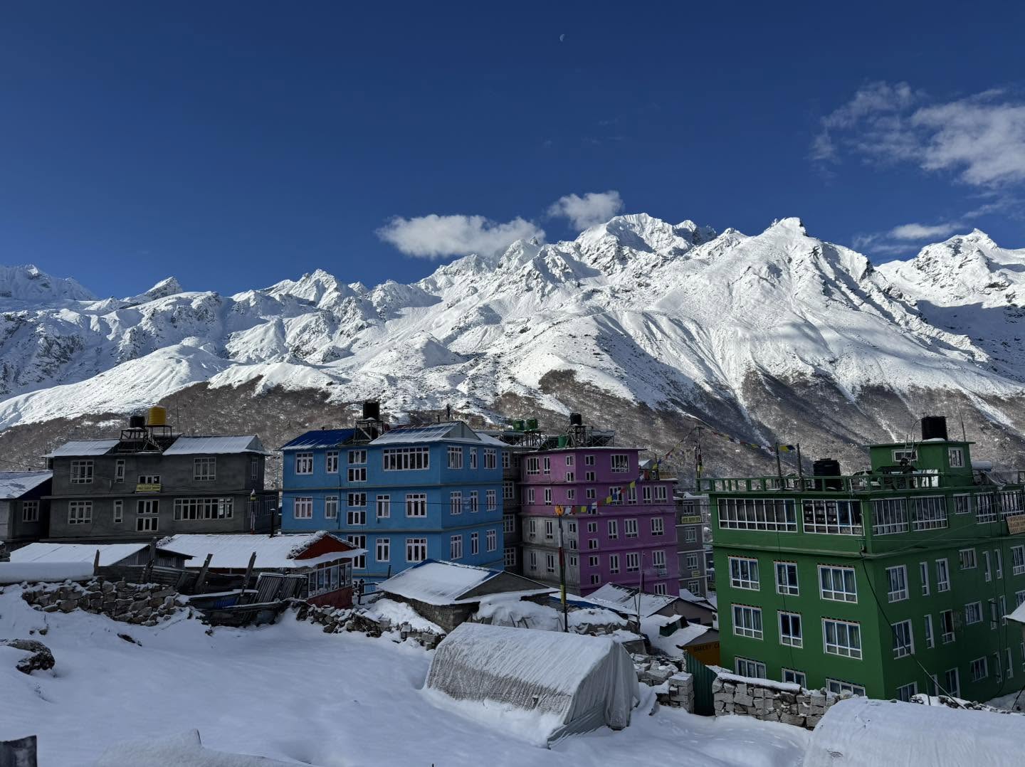
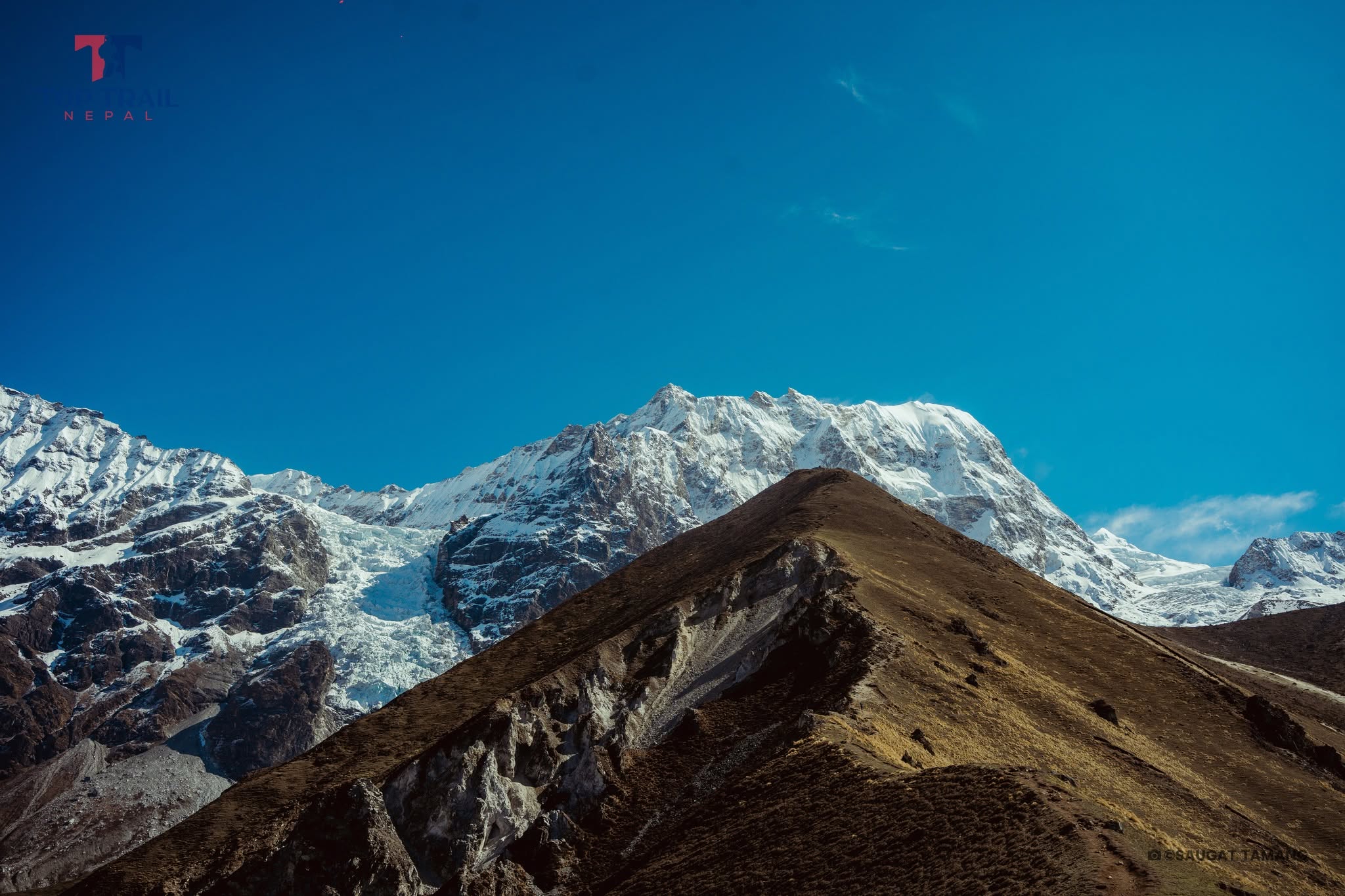
Above Lama Hotel, the valley begins to change. After passing Ghoda Tabela, dense forest gradually gives way to open slopes, grazing land and wider views of the Langtang Himal. Langtang Lirung at 7,245 m becomes one of the dominant mountains above the valley as you approach Langtang Village.

Langtang Village is much more than an overnight stop. The community was devastated by the earthquake and avalanche of 2015 and has since been rebuilt by local residents. Staying here gives trekkers an opportunity to support the valley directly while experiencing the resilience and hospitality of the people who call Langtang home.
Culture remains an important part of the journey as the trail climbs higher. The region is home largely to Tamang communities, whose language, houses, farming traditions and Buddhist practices give Langtang a distinctive identity. Mani walls, prayer wheels, chortens, monasteries and prayer flags become increasingly common as you approach the upper valley.

The walk from Langtang Village to Kyanjin Gompa is shorter than the previous trekking days, allowing more time to enjoy the change into open alpine country. Kyanjin sits beneath glaciers and high Himalayan peaks and serves as the base for exploring the upper valley. The monastery, traditional settlement and local cheese-making heritage add another side to the experience beyond the mountain scenery.
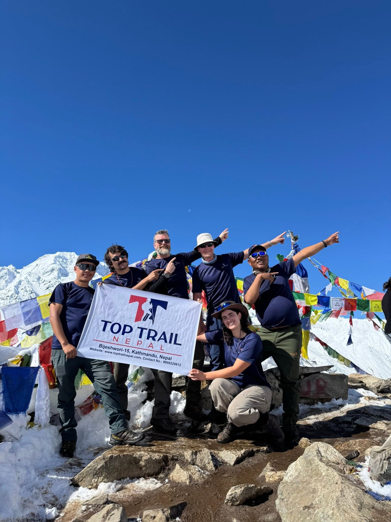
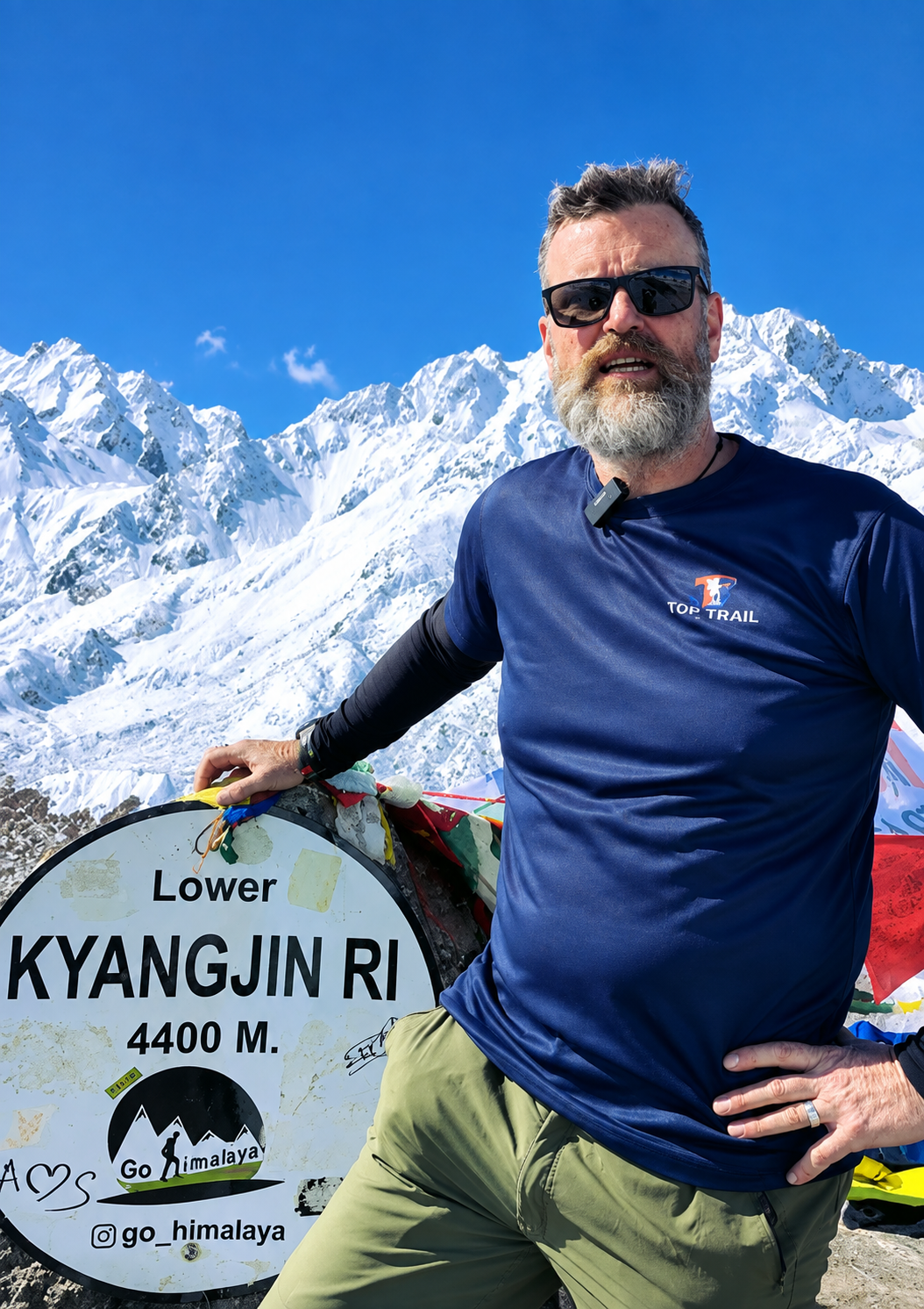
The high point of the trek comes with the climb to Kyanjin Ri at 4,773 m. The ascent is steep and the altitude makes it demanding, but on a clear day the viewpoint opens a broad panorama over the Langtang Valley, glaciers and surrounding peaks including Langtang Lirung, Yala Peak and other summits of the Langtang Himal.

After reaching Kyanjin Ri, the route descends through Langtang Village and the forests of the lower valley before returning to Syabrubesi. In only nine days from arrival to departure, the trek combines forest trails, Tamang culture, rebuilt mountain communities, Buddhist heritage, alpine landscapes and a viewpoint approaching 4,800 m without requiring a long expedition.
Highlights of the Langtang Valley Short Trek
- Climb to Kyanjin Ri at 4,773 m, the highest point of the itinerary, for wide views across the upper Langtang Valley.
- Reach Kyanjin Gompa at 3,870 m, a high mountain settlement surrounded by glaciers and Himalayan peaks.
- Enjoy close views of Langtang Lirung at 7,245 m, Yala Peak and other mountains of the Langtang Himal.
- Walk beside the Langtang Khola through bamboo, oak, rhododendron and pine forests before emerging into open alpine country.
- Experience the culture of the Tamang communities through traditional settlements, monasteries, mani walls, chortens and prayer wheels.
- Spend time in Langtang Village and learn about a community that rebuilt itself following the devastating 2015 earthquake and avalanche.
- Travel through Langtang National Park, home to red pandas, musk deer, Himalayan black bears, Himalayan tahr, ghoral and other mountain wildlife.
- Watch the landscape change from deep river valleys and forest to yak-grazing country, glaciers and rocky high-altitude terrain.
- Complete a varied Himalayan journey in a compact 9-day Kathmandu-to-Kathmandu itinerary, making Langtang an excellent choice when trekking time is limited.
Detailed Itinerary - Langtang Valley Short Trek (9 Days)
Your Langtang journey begins in Kathmandu. After landing at Tribhuvan International Airport, a representative from Top Trail Nepal will meet you and transfer you to your hotel.
The rest of the day is intentionally relaxed. You can recover from your flight, explore the streets around Thamel or pick up any trekking items you may still need.
Before leaving for the mountains, we will also go through the route with you, including the road journey to Rasuwa, accommodation along the trail, expected weather and the gradual increase in altitude toward Kyanjin Gompa.
After breakfast, we leave Kathmandu and head north toward Rasuwa and the entrance to the Langtang region.
The road initially follows busy valleys and cultivated hills before becoming increasingly mountainous. We travel through the Trishuli corridor and continue toward Dhunche, with forests, terraced slopes and scattered settlements lining much of the journey.
Beyond Dhunche, the road winds down toward Syabrubesi, the traditional starting point for the Langtang Valley trail. The journey is not particularly long in distance, but the winding mountain road means it takes most of the day.
After arriving, you settle into the teahouse and prepare for the first day on foot.
Distance: Around 120–125 km by road
Drive Hours: Around 6–8 hrs
The trek begins by following the Langtang Khola into a deep, forested valley.
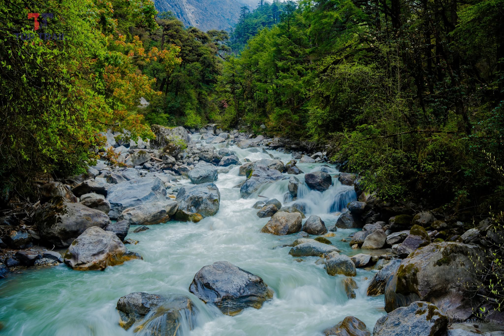
Much of today’s trail stays close to the river, crossing suspension bridges and climbing through oak, rhododendron, maple and bamboo woodland. The path rarely stays completely level, with repeated climbs and shorter descents making the day feel more demanding than the distance alone might suggest.
Small riverside settlements provide places to stop for tea or lunch before the trail continues steadily upward.
By late afternoon, you reach Lama Hotel, a collection of teahouses tucked into the forest beside the Langtang River. The surroundings here feel noticeably cooler and quieter than Syabrubesi.
The character of the valley begins to change considerably today.
Leaving Lama Hotel, you continue upstream beneath tall forest and steep mountain slopes. Waterfalls appear beside the trail, and after several hours you reach the area around Ghoda Tabela, where the dense woodland begins to thin.
From here, the valley becomes broader and the mountains finally start to dominate the horizon. In clear weather, Langtang Lirung rises dramatically above the valley as you continue through grazing areas and scattered settlements.
The route eventually reaches Langtang Village, one of the most important communities in the region. The village was devastated during the 2015 earthquake and avalanche and has since been rebuilt, making this part of the trek both beautiful and deeply connected with the recent history of the valley.
You spend the night here beneath the surrounding Langtang peaks.
Today’s walk is intentionally shorter, giving you more time to adjust as you approach 4,000 m.
Leaving Langtang Village, the route passes through smaller settlements and open yak-grazing country. Mani walls, chortens, prayer wheels and stone structures appear beside the trail, reflecting the Buddhist traditions of the upper valley.
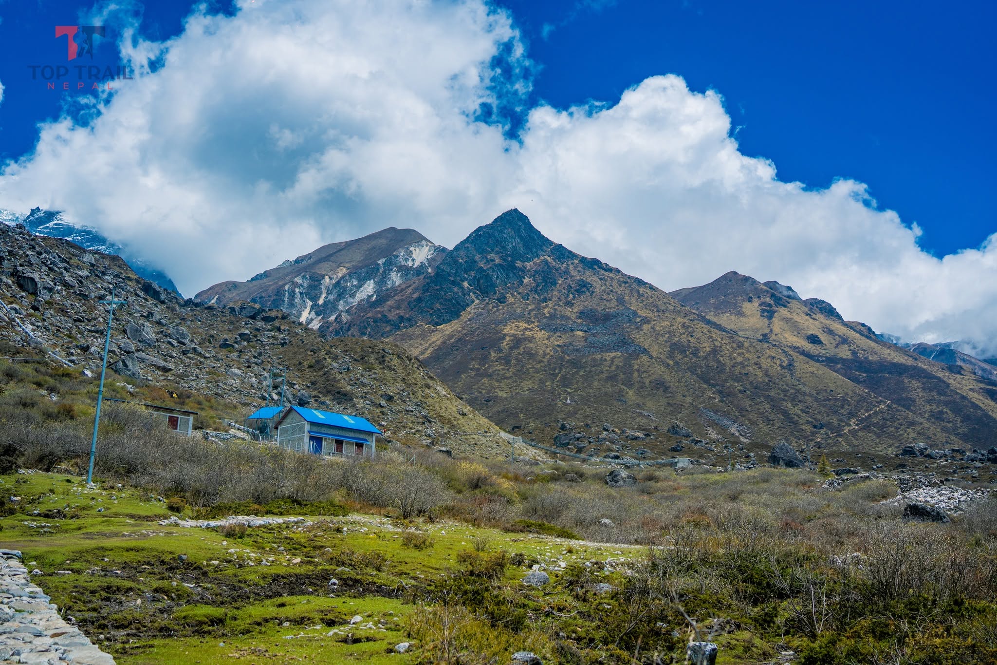
The forest now lies behind you. Instead, the path crosses a broad alpine landscape surrounded by increasingly close views of glaciers and snow-covered mountains.
After around three to four hours, you reach Kyanjin Gompa at 3,870 m, the highest permanent settlement on our main trekking route.
The afternoon is free for a slow exploration of the village. You can visit the monastery, walk around the surrounding moraine or stop at the local cheese factory before resting for tomorrow’s high-altitude hike.
Today brings the highest point of the trek and some of its finest mountain scenery.
We start early and climb directly above Kyanjin Gompa toward Kyanjin Ri. The trail is steep but non-technical, rising quickly above the village into open alpine terrain.
As you gain height, the entire upper Langtang Valley begins to spread out below. From the higher ridge and viewpoint, clear weather reveals impressive views toward Langtang Lirung, Kimshung, Yala Peak, surrounding glaciers and the high peaks enclosing the valley.
At approximately 4,773 m, Kyanjin Ri is the highest point of our standard 9-day itinerary. The altitude makes the ascent demanding, so the pace remains steady and there is no need to rush.
After enjoying the viewpoint, we descend back to Kyanjin Gompa for a rest and something to eat. Rather than spending another night at the same altitude, we then continue down the familiar valley trail to Langtang Village.
This combination gives you the high viewpoint experience while also beginning the descent and placing us in a better position for the following day.
This is the longest walking day of the trek, but almost all of the major elevation gain is now behind us.
After breakfast, you retrace the route down the Langtang Valley, passing Ghoda Tabela and gradually returning to thicker forest.
The change in scenery is surprisingly quick. The open alpine slopes around Langtang give way to rhododendron, oak and bamboo forest as you descend toward Lama Hotel and the lower river valley.
We continue following the Langtang Khola through the familiar series of bridges, forest paths and small settlements before finally returning to Syabrubesi.
Although the day is long, descending to Syabrubesi allows us to keep the following day entirely for the road journey rather than combining many hours of trekking and driving.
After the long descent yesterday, today is reserved entirely for the return journey to Kathmandu.
We leave Syabrubesi after breakfast and follow the mountain road back through the Rasuwa hills. The route climbs through the Dhunche area before gradually returning toward the lower Trishuli Valley and Kathmandu.
Road conditions, construction, landslides and traffic can all affect the actual travel time, so the drive is best treated as a full travel day rather than trying to combine it with a substantial trekking stage.
After reaching Kathmandu, you transfer to your hotel and have the rest of the evening free.
Distance: Around 120–125 km by road
Drive Hours: Around 6–8 hrs
Your Langtang Valley Short Trek comes to an end today.
Depending on the timing of your international flight, you may have some free time for breakfast, shopping or a final walk around Kathmandu.
A representative from Top Trail Nepal will transfer you to Tribhuvan International Airport for your onward journey.
In nine days, the route has taken you from Kathmandu and the forested lower Langtang Valley to the rebuilt communities of the upper valley, Kyanjin Gompa and finally the high viewpoint of Kyanjin Ri at 4,773 m.
What's Included
Airport Transfers
|
Hotel Accommodation in Kathmandu
|
Ground Transportation
|
Meals During the Trek
|
Teahouse Accommodation
|
Professional Trekking Staff
|
All Required Trekking Permits
|
Safety & Medical Support
|
Taxes & Service Charges
|
What's Not Included
International Travel & Visa
|
Meals in Kathmandu
|
Travel Insurance
|
Personal Trekking Gear
|
Personal Expenses
|
Tips for Trekking Staff
|
Emergency Evacuation Costs
|
Any Other Costs
|
Departure Dates
Route Map & Gallery








Frequently Asked Questions - Langtang Valley Short Trek
Our Langtang Valley Short Trek is a 9-day Kathmandu-to-Kathmandu itinerary, including arrival and final departure days. The trekking route runs from Syabrubesi through Lama Hotel, Langtang Village and Kyanjin Gompa before hiking to Kyanjin Ri and returning to Kathmandu.
The highest point is Kyanjin Ri at 4,773 m. Kyanjin Gompa at 3,870 m is the highest overnight stop on the standard itinerary.
The trek is best described as moderate to challenging. Most of the valley trail is non-technical, but there are long walking days, repeated climbs and descents, and a steep high-altitude ascent to Kyanjin Ri.
Yes, a fit beginner can complete the trek with proper preparation and a steady pace. Previous trekking experience is helpful but not essential, although the altitude and Kyanjin Ri climb mean the trek should not be treated as an easy walk.
The best seasons are generally spring from March to May and autumn from October to November. Spring brings flowering rhododendrons and greener forests, while autumn usually offers clearer skies and excellent Himalayan visibility.
Yes. Under Nepal’s current trekking system, the Langtang Trek is covered by the licensed-guide and agency-issued TIMS requirement. Your guide also helps with navigation, accommodation, altitude awareness and changing weather or trail conditions.
You need a Langtang National Park Entry Permit and an agency-issued TIMS Card. Top Trail Nepal arranges the required trekking documentation before departure.
Yes. The itinerary reaches 4,773 m at Kyanjin Ri, so altitude sickness is possible. Walk at a steady pace, drink enough water and report symptoms such as persistent headache, nausea, dizziness or unusual weakness to your guide immediately.
Accommodation is mainly in local teahouses and mountain lodges, usually in simple twin-sharing rooms. Facilities are generally better in Syabrubesi and become simpler higher in the valley, with shared bathrooms common in many lodges.
Teahouses usually serve meals such as dal bhat, noodles, soups, fried rice, pasta, potatoes, eggs, Tibetan-style bread and seasonal vegetables. Tea, coffee and other hot drinks are also widely available.
Electricity, mobile signal and Wi-Fi are available in some settlements, but reliability decreases higher in the valley. Charging may also cost extra at teahouses, so carrying a power bank is recommended.
Most trekking days involve around 4 to 7 hours of walking. Longer stages, including the Kyanjin Ri day and the descent toward Syabrubesi, can take around 7 to 9 hours depending on pace and trail conditions.
Yes. The itinerary can be customized by adding extra days, side hikes, or combining it with nearby routes like Tamang Heritage Trail.
Yes, with good preparation. The shorter duration and moderate altitude make it suitable for families and senior trekkers in good health.
Useful Info
The Langtang Valley Short Trek is a compact journey, but it still reaches genuine high-altitude terrain. From the forests above Syabrubesi, the route climbs to Langtang Village and Kyanjin Gompa before reaching Kyanjin Ri at 4,773 m. Knowing what to expect from the altitude, weather, accommodation and trail conditions will help you prepare properly for the nine-day trip.
The following information covers the main practical details for the trek, including the best seasons, difficulty, acclimatization, accommodation, meals, guides, permits, road transport, drinking water, communication, insurance and equipment.
Langtang Valley Short Trek Highlights
| Information | Details |
|---|---|
| Duration | 9 Days |
| Trekking Region | Langtang Valley, Rasuwa |
| Trailhead | Syabrubesi |
| Highest Point | Kyanjin Ri – 4,773 m |
| Main High Settlement | Kyanjin Gompa – 3,870 m |
| Difficulty | Moderate to Challenging |
| Accommodation | Teahouses and local mountain lodges |
| Protected Area | Langtang National Park |
Best Time for the Langtang Valley Short Trek
The most favourable periods for trekking in Langtang are spring from March to May and autumn, particularly October and November. These months generally provide better visibility and more comfortable conditions for walking through both the lower forests and the upper valley.
Spring brings flowering rhododendrons and fresh vegetation to the forest sections, while autumn is known for clearer Himalayan views after the monsoon. September can also be suitable as the rains begin to withdraw, although conditions early in the month can still be wet.
| Season | What to Expect | Suitability |
|---|---|---|
| March – May | Milder temperatures, flowering rhododendrons and generally good mountain visibility. | Excellent |
| June – September | Monsoon rain, muddy forest trails, leeches, cloud and possible road disruption. | Less suitable |
| October – November | Clearer skies, excellent mountain views and generally favourable trail conditions. | Excellent |
| December – February | Cold mornings and nights, with possible snow around Kyanjin and the higher viewpoints. | More demanding |
How Difficult Is the Trek?
The Langtang Valley Short Trek is best described as moderate to challenging. Most of the main valley trail is non-technical, but the itinerary includes substantial elevation gain, uneven mountain paths and several long walking days.
The lower route includes forest climbs, stone steps and frequent changes in elevation. The greatest physical challenge comes on the climb to Kyanjin Ri at 4,773 m, where the combination of a steep trail and thin air makes progress considerably slower.
You should be comfortable walking for around 5 to 8 hours on demanding days. The return from Langtang Village to Syabrubesi is also a long descent, so endurance and strong legs are useful even after the highest point has been completed.
Altitude and Acclimatization
The itinerary gains altitude progressively rather than jumping directly into the high mountains. You travel from Syabrubesi through Lama Hotel and Langtang Village before sleeping at Kyanjin Gompa at 3,870 m.
There is no separate full acclimatization day in this short itinerary, which makes steady pacing particularly important. Day 5 is intentionally shorter, allowing time at Kyanjin before attempting Kyanjin Ri the following morning.
| Location | Altitude | Stage |
|---|---|---|
| Syabrubesi | 1,550 m | Trekking trailhead |
| Lama Hotel | 2,380 m | Lower forest overnight |
| Langtang Village | 3,430 m | First overnight above 3,000 m |
| Kyanjin Gompa | 3,870 m | Highest overnight point |
| Kyanjin Ri | 4,773 m | Highest point of the trek |
Altitude sickness can affect anyone regardless of age or fitness. Persistent headache, dizziness, nausea, unusual tiredness, loss of coordination or breathing difficulty should be reported to your guide immediately. Reaching a viewpoint is never more important than responding properly to altitude-related symptoms.
Safety on the Langtang Trail
Langtang is a well-established trekking route with villages and teahouses along much of the main trail, but it is still a Himalayan environment. Weather can change quickly, trails can become slippery after rain or snow, and the higher sections are exposed to cold and strong wind.
Stay on the established trail, follow your guide’s instructions and avoid rushing at altitude. The Kyanjin Ri ascent should only be attempted when your health, the weather and trail conditions are suitable. Your guide may change the day’s plan when conditions make the original objective unreasonable.
Accommodation Along the Route
Accommodation during the trekking section is mainly in local teahouses and mountain lodges. Most rooms are simple and usually arranged on a twin-sharing basis.
Syabrubesi generally has a wider selection of accommodation and facilities. Higher in the valley, lodges become simpler, although Langtang Village and Kyanjin Gompa now have a reasonable network of teahouses serving trekkers.
Shared bathrooms are common. Hot showers, Wi-Fi and charging may be available at some lodges for an additional fee, but services vary and should not be treated as guaranteed.
Meals During the Trek
Breakfast, lunch and dinner are provided during the trekking days and are taken at local teahouses along the route.
Menus typically include dal bhat, noodles, soups, fried rice, pasta, potatoes, eggs, Tibetan-style bread and seasonal vegetables. Tea, coffee and other hot drinks are widely available. Choices are usually better in the larger settlements and can become simpler higher in the valley.
Guide and Trekking Support
Under Nepal’s current trekking system, the Langtang Trek is listed among routes requiring a licensed trekking guide and an agency-issued TIMS Card.
Your trekking guide assists with navigation, accommodation, daily pacing, weather information, altitude awareness and communication with the teahouses. This becomes particularly useful in poor weather or when deciding whether conditions are suitable for the Kyanjin Ri ascent.
Permits for the Langtang Valley Trek
The route lies within Langtang National Park, so a national park entry permit is required in addition to the trekking documentation used under the current TIMS system.
| Permit / Requirement | Current Information |
|---|---|
| Langtang National Park Permit | NPR 3,000 for foreign visitors and NPR 1,500 for SAARC visitors. |
| TIMS Card | NPR 2,000 for non-SAARC trekkers and NPR 1,000 for SAARC trekkers under the current agency-issued system. |
| Licensed Guide | Required for the Langtang Trek under the current TIMS provision. |
Top Trail Nepal arranges the required trekking permits and documentation before departure. Government fees and trekking regulations can change, so the applicable requirements are reconfirmed for your travel dates.
Weather in the Langtang Valley
Conditions change noticeably as you climb from Syabrubesi to Kyanjin. The lower valley is warmer and more humid, while Langtang Village and Kyanjin experience colder nights and a much more alpine climate.
| Area | General Conditions |
|---|---|
| Syabrubesi / Lower Valley | Warmer, greener and more humid, particularly during the monsoon. |
| Langtang Village | Cooler mountain conditions with cold evenings and mornings. |
| Kyanjin Gompa | Cold at night, with snow possible during winter and unsettled periods. |
| Kyanjin Ri | Exposed high-altitude conditions with stronger wind, colder temperatures and rapid weather changes. |
Road Journey to Syabrubesi
The standard trek begins with a road journey from Kathmandu toward Dhunche and Syabrubesi. Although the distance is relatively modest, the mountain road is winding and road conditions can make the journey considerably longer than the kilometre count suggests.
Rain, landslides, road maintenance and other local conditions can affect access in Rasuwa. Transportation arrangements are therefore reconfirmed before departure, and an alternative access plan may be used when the usual approach is temporarily unavailable.
Drinking Water
Water is available at teahouses and settlements throughout the main route, but untreated stream or tap water should not be consumed directly. Carry a reusable bottle and use boiled water, purification tablets, drops or a reliable water filter when necessary.
Electricity, Wi-Fi and Mobile Network
Electricity, mobile signal and internet access are available in parts of the Langtang Valley, but reliability varies from village to village. Charging and Wi-Fi may also involve an additional lodge fee.
A power bank is useful for the higher sections, particularly if you use your phone for photography or navigation. Important documents and maps should be downloaded before leaving Kathmandu rather than relying entirely on mobile data.
Travel Insurance and Emergency Evacuation
Travel insurance is strongly recommended for the Langtang Valley Short Trek. Your policy should cover high-altitude trekking to at least 4,800 m, medical treatment and emergency helicopter evacuation.
Emergency evacuation and medical treatment are not normally included in the trekking package. Check the altitude limit and evacuation conditions of your insurance carefully before travelling rather than assuming all trekking activities are automatically covered.
What to Pack for Langtang
| Category | Recommended Items |
|---|---|
| Clothing | Trekking shirts, fleece, warm jacket, thermal layers, trekking trousers and waterproof outer layers. |
| Footwear | Well broken-in trekking boots, comfortable trekking socks and lightweight footwear for evenings. |
| Cold Weather Gear | Warm gloves, thermal hat and suitable insulation for Kyanjin and Kyanjin Ri. |
| Sleeping Gear | Warm sleeping bag suitable for cold nights in the upper valley. |
| Trekking Equipment | Trekking poles, headlamp, sunglasses, sunscreen, reusable water bottles, rain protection and power bank. |
| Personal Items | Personal medication, toiletries, basic first-aid items, snacks and a quick-drying towel. |
| Documents | Passport, travel insurance details, emergency contacts and required travel documents. |
Responsible Trekking in Langtang
The entire trekking route passes through Langtang National Park, where forests, alpine habitat and mountain wildlife are protected. The park supports species including red panda, musk deer, Himalayan black bear, Himalayan tahr, ghoral, serow and snow leopard.
Use refillable water bottles where possible, carry rubbish until it can be disposed of properly and avoid disturbing wildlife. The villages along the route also have strong Tamang and Buddhist traditions, so monasteries, mani walls, prayer wheels and local customs should be treated respectfully.
Important: Walking times, road access, weather, trail conditions and the Kyanjin Ri ascent can change according to local conditions. Top Trail Nepal may adjust transportation or the daily trekking plan when necessary for safety, altitude or operational reasons.
Book Langtang Valley Short Trek with Confidence
Join Top Trail Nepal, your trusted local trekking agency in Kathmandu, for the journey of a lifetime. Our experienced guides, strong safety record, and personal service make your Everest dream come true.

- $800 1 people
- $775 2 people
- $745 4-6 people
- $685 7-12 people