
 Call Us or Whatsapp 9779808220612
 Email Us [email protected]
- English [EN]
- Espanol [ESP]
- France [FR]
- Deutsch [DE]
- China [CN]
- Japan [JP]
- Arabic [AR]
- Hindi [HI]

Manaslu Circuit Trek
 Duration: 14 Days
 Difficulty: Challenging
 Accomodation: Hotel / Lodge / Teahouse
 Meal: B -L - D
 Max. Altitude: 5,167 m
 Best Seasons: Spring (March-April-May) & Autumn (Sep-Oct-Nov)
Manaslu Circuit Trek


Detailed Itinerary - Manaslu Circuit Trek (14 Days)
Your Manaslu Circuit Trek begins with your arrival at Tribhuvan International Airport in Kathmandu. Our representative will meet you at the airport and transfer you to your hotel. After check in, you can rest and recover from your journey while our team completes the necessary preparations for the trek.
Later in the day, there will be a trek briefing covering the route, permits, altitude precautions, equipment and the daily walking schedule. Kathmandu is also the place to make any final preparations before heading into the remote Manaslu region.
Today you leave Kathmandu and travel toward the Manaslu region by road. The journey passes through the changing landscapes of central Nepal, beginning with busy urban areas before following winding mountain roads through hills, rivers, terraced farmland and small settlements.
The road gradually enters the Budhi Gandaki corridor, bringing you closer to the trailhead. Depending on road and traffic conditions, the drive takes most of the day, and the final sections can be rough and uneven. Machha Khola is a small riverside settlement and the starting point for the main trekking section of the circuit.
Distance: Approximately 157 km by road
The first full trekking day follows the Budhi Gandaki River through a constantly changing landscape of narrow valleys, forests, rocky sections and small mountain settlements. The trail crosses suspension bridges and passes through traditional villages while gradually gaining altitude.
You will also reach Tatopani, which is well-known for its hot springs, after passing Khorlabesi (920m) and the Machha River. After that, the trail passes through a wooded area on its approach to the Budhi Gandaki Valley and the Dovan Khola.
You will encounter waterfalls, exposed cliffside paths and sections where the river cuts deeply through the valley. As the route continues north, the surroundings become more rugged and the villages more distinctly Himalayan. Jagat is an important settlement on the Manaslu trail and marks a clear transition into the higher and more restricted sections of the journey.
We travel the trek down the valley to Sirdibas, which offers breathtaking views of the Shringi Himal. The trail continues through the narrow Budhi Gandaki Valley, crossing suspension bridges and moving between forested slopes, waterfalls and steep rock faces.
The route passes through several small settlements and follows sections of the river where the valley becomes noticeably deeper and more dramatic. You have to make a difficult ascent to Philim after crossing a suspension bridge. You then continue up through the valley, passing via Ekle Bhatti and Pewa Village before arriving in Deng Village, where we will spend the night in a guesthouse.
As you gain elevation, the landscape gradually changes and the influence of Tibetan culture becomes more visible. Deng, also known as Dyang, is located in a more remote part of the valley and provides an important overnight stop before the route climbs toward Namrung and the upper Manaslu region.
The trek to Namrung involves a steady climb through increasingly mountainous terrain. The trail follows the Budhi Gandaki through forests and steep-sided valleys, with sections passing beneath impressive cliffs and across traditional suspension bridges.
As the altitude rises, the vegetation changes and the villages begin to show stronger Tibetan influence. You will return to Namrung for our overnight stay at a teahouse after making a little diversion to Prok hamlet in the afternoon, which will take two hours.
Today the trail enters the high mountain environment of the Nubri Valley. From Namrung, the route climbs through forests and open mountain terrain, passing traditional villages, cultivated fields and stone-built settlements shaped by Tibetan Buddhist culture.
The surrounding peaks become increasingly impressive as the route approaches Lho. On clear days, there are excellent views toward Mount Manaslu at 8,163 m and the surrounding Himalayan range. The snow-covered summit of Ngadi Chuli, also known as summit 29, is visible from Lho.
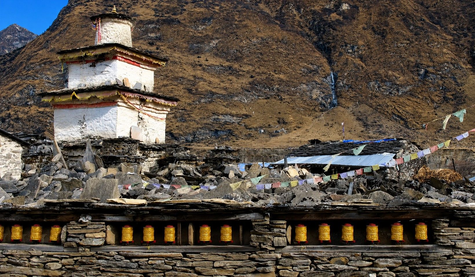
Lho is one of the most scenic and culturally important villages on the circuit, with its monastery, prayer flags, mani walls and traditional houses providing a strong sense of the region’s Tibetan heritage. The village feels like you are traveling back in time.
The landscape opens dramatically as you continue higher toward Samagaon. The trail passes through forests and alpine meadows before reaching the broader upper Budhi Gandaki Valley, where the views of Manaslu and surrounding peaks become more dominant.
Along the way, you pass through smaller settlements and areas of cultivated land before reaching Samagaon, the largest village in the upper valley. Its traditional stone houses, mani walls and Buddhist structures reflect the strong Tibetan cultural influence of the region. Samagaon is also an important acclimatization stop before continuing toward Samdo and the Larkya La pass.
Today is set aside for acclimatization before the trek moves into higher elevations. Rather than spending the entire day inactive, a gradual hike helps your body adjust to the thinner air while allowing you to explore the remarkable landscape around Samagaon.
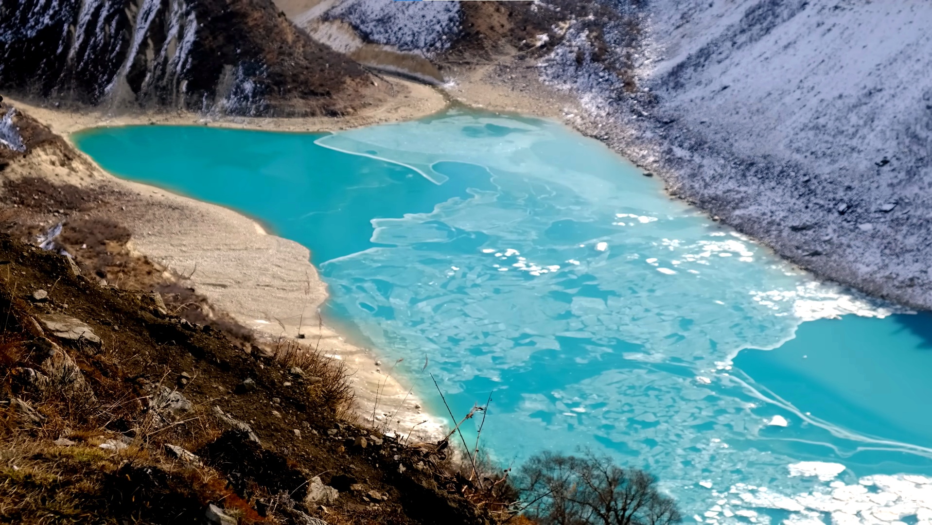
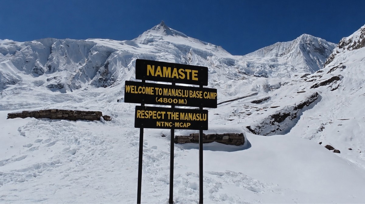
Depending on conditions and your guide’s recommendation, you may hike toward Birendra Lake, Pungyen Gompa or Manaslu Base Camp overlooking the Manaslu glacier and surrounding mountains. The exact activity can be adjusted according to weather, fitness and altitude response. The aim is to gain some elevation during the day and return to Samagaon for the night.
Distance: Approximately 5 to 8 km depending on the acclimatization hike
After acclimatization, the trail continues through the upper Budhi Gandaki Valley toward Samdo. The route is shorter today, allowing for a gradual gain in altitude as you leave the more developed landscape around Samagaon.
The trail crosses open alpine terrain with increasingly barren slopes of Larjyang La , long mountain ridges and views of glaciers and high Himalayan peaks. Samdo is one of the highest permanent settlements along the circuit and has a distinct Tibetan character because of its location close to the Nepal Tibet border region. You will see Larkya La trail on the left side of the valley.
Today you enter the final high altitude section before the Larkya La crossing. The trail climbs gradually from Samdo across open mountain terrain, following a route shaped by glacial valleys and high Himalayan ridges. Before reaching Larkya Bazaar, a settlement that serves as a commercial hub for traders traveling down from Tibet, we will need to cross Budi Gandaki river and few seasonal streams.
After that, we must ascend a tough yet short trek to reach Dharamsala (Larkya Phedi), where we will spend the night in a guesthouse. Because of the altitude, today’s walk is deliberately shorter, allowing you to rest and prepare for the demanding crossing the following morning.
This is the highest and most challenging day of the Manaslu Circuit. You will begin early from Larkya Phedi and climb gradually toward Larkya La Pass at 5,167 m, where altitude, cold temperatures, wind and possible snow can make the crossing physically demanding. In order to reach the high, snow-covered pass, we must first ascend to Cho Chanda.
The views of the numerous nearby peaks are very breathtaking. From the pass, it is easy to see the Himalayan mountains of Himlung Himal (7,126m), Cheo Himal (6820m), Gyaji Kung (7,030m), Kang Koru (6,98m), and Annapurna II (7,937m). After that, we traverse moraines and descend a rocky trail till we reach Bhimthang Village, where we will spend the night in teahouse.
After the demanding pass crossing, today’s trail follows a long descent through increasingly green surroundings. You leave the high alpine landscape behind and walk through forests, open meadows and river valleys as the altitude drops.
The route passes through traditional settlements and continues along the Marsyangdi Valley side of the circuit. Tilije is a well known stopping point with a mix of Tibetan influenced and lower Himalayan culture, and the lower elevation makes this a much more comfortable evening after the previous day’s high altitude crossing.
Your Manaslu Circuit Trek officially comes to an end today. Depending on your flight schedule, Top Trail Nepal will arrange your transfer to Tribhuvan International Airport for your onward journey.
This final day is kept free of trekking or long road travel after completing the Manaslu Circuit and crossing Larkya La. You can buy stroll around the Kathmandu UNESCO sites or make a last-minute shopping before heading home.
What's Included
Airport Transfers
|
Hotel Accommodation in Kathmandu
|
Transportation
|
Meals During the Trek
|
Teahouse Accommodation
|
Professional Trekking Team
|
All Required Trekking Permits
|
Safety Support, Medical Kit and Gifts
|
Government Taxes & Service Charges
|
What's Not Included
|
International Airfare
|
|
Nepal Visa
|
|
Travel Insurance
|
|
Personal Trekking Equipment
|
|
Personal Expenses
|
|
Tips for Guides, Porters & Trekking Staff
Gratuities are appreciated but voluntary and are not included in the package price.
|
|
Emergency Evacuation
Helicopter rescue, medical evacuation and related emergency transportation costs are not included. These costs may be covered by travel insurance if you have appropriate coverage.
|
|
Any Other Costs
Any services, expenses or activities not specifically mentioned in the What’s Included section.
|
Departure Dates
Route Map & Gallery







Frequently Asked Questions - Manaslu Circuit Trek
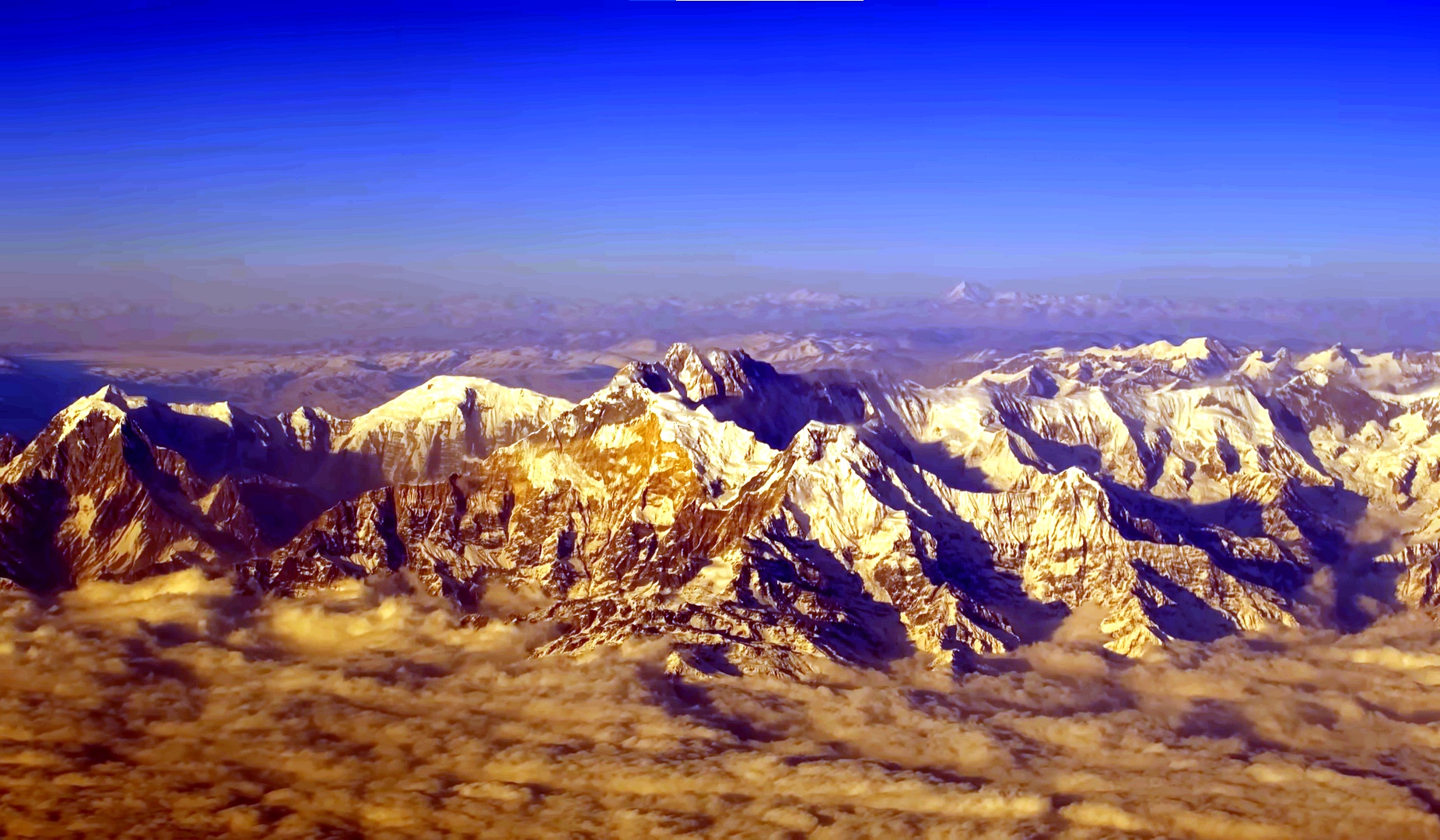
The Manaslu Trek, also known as the Manaslu Circuit Trek, is a remote Himalayan trekking route that circles Mount Manaslu (8,163m), the eighth-highest mountain in the world. It is known for its dramatic scenery, cultural villages, and fewer crowds compared to Everest and Annapurna.
The Manaslu Trek is located in north-central Nepal, near the Tibetan border, within the Manaslu Conservation Area and partially through restricted regions.
The Manaslu Trek is considered moderate to challenging. It involves long walking days, high altitude, and crossing a high mountain pass, making it suitable for trekkers with good fitness and prior trekking experience.
A standard Manaslu Circuit Trek itinerary takes 14 to 18 days, depending on acclimatization days, route variation, and walking pace.
The highest point is Larkya La Pass (5,160 meters), one of the most scenic and challenging passes in Nepal.
The best seasons for the Manaslu Trek are:
- Spring (March–May) – Pleasant temperatures and blooming rhododendrons
- Autumn (September–November) – Clear skies and excellent mountain views
Winter is colder with heavy snow, and monsoon season is not recommended.
Trekkers need multiple permits:
- Manaslu Restricted Area Permit (RAP)
- Manaslu Conservation Area Permit (MCAP)
- Annapurna Conservation Area Permit (ACAP)
All permits are arranged through a registered trekking agency.
Yes. The trek reaches elevations above 5,000 meters, so altitude sickness is a potential risk. Proper acclimatization, hydration, and a gradual ascent are essential.
Accommodation is mainly teahouse-based lodges offering basic but comfortable rooms. Facilities become more basic at higher elevations.
Yes. The Manaslu region is a restricted area, and trekking is only permitted with a licensed guide and through a registered trekking company.
The Manaslu Trek is not ideal for first-time trekkers. Previous high-altitude trekking experience is strongly recommended due to its remoteness and altitude.
Limited Wi-Fi and charging facilities are available in some villages, but service is unreliable and often unavailable in higher or remote areas.
Trekkers can enjoy views of:
- Mount Manaslu (8,163m)
- Himalchuli, Ngadi Chuli, Ganesh Himal, and surrounding peaks
Yes. The Manaslu Trek itinerary can be customized with additional acclimatization days, side hikes, or by combining it with Tsum Valley based on your preferences.
Useful Info
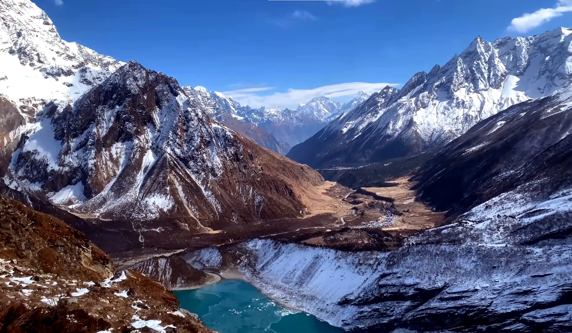
The Manaslu Circuit Trek takes you from the lower Budhi Gandaki Valley into the high Himalayan landscape surrounding Mount Manaslu. The route passes through changing climates, traditional mountain villages, Tibetan influenced communities, forests, river valleys, alpine terrain and the high Larkya La crossing.
Conditions and facilities change considerably as the trail gains elevation. The information below covers the practical details you should know before starting the Manaslu Circuit Trek, including accommodation, transportation, fitness, altitude, permits, food, water, connectivity, weather and trekking preparation.
Best Time for the Manaslu Circuit Trek
The main trekking seasons for the Manaslu Circuit are spring from March to May and autumn from September to November. These periods generally provide more favorable conditions for trekking, better mountain visibility and more suitable conditions for crossing Larkya La.
Spring brings warmer temperatures to the lower valleys and flowering rhododendron forests, while autumn usually offers clearer mountain views after the monsoon. Winter can bring heavy snowfall and very cold conditions around the higher sections, while the summer monsoon can affect the lower trails and road approach with rain, landslides and reduced visibility.
| Season | Typical Conditions | Suitability |
|---|---|---|
| March to May | Warmer lower valleys, spring flowers and generally favorable trekking conditions | Excellent |
| June to August | Monsoon rain, wet trails, cloud and possible road or landslide disruptions | Less suitable |
| September to November | Generally clearer skies, good mountain visibility and stable autumn conditions | Excellent |
| December to February | Cold temperatures, possible heavy snow and difficult conditions around Larkya La | Limited and condition dependent |
Accommodation During the Trek
Accommodation during the Manaslu Circuit is mainly provided by local teahouses and mountain lodges. In Kathmandu, you will stay in a 3-star category hotel, while the trekking section uses simple lodge and teahouse accommodation.
Facilities are generally more developed in the lower villages and become simpler as the trail climbs toward Samagaon, Samdo and Larkya Phedi. Rooms are normally basic and arranged on a twin-sharing basis. Shared bathrooms are common at higher elevations, while hot showers, Wi-Fi and charging facilities may be available for an additional fee in some lodges.
| Place | Elevation | Accommodation | What to Expect |
|---|---|---|---|
| Kathmandu | 1,350 m | 3-star hotel | Private room and standard city facilities |
| Machha Khola | 870 m | Teahouse | Basic mountain accommodation |
| Jagat | 1,410 m | Teahouse | Simple lodge rooms and shared facilities |
| Deng | 1,860 m | Teahouse | Small mountain lodges and basic facilities |
| Namrung | 2,630 m | Teahouse | Several lodge options and more developed facilities |
| Lho | 3,180 m | Teahouse | Simple mountain lodging in a Tibetan influenced village |
| Samagaon | 3,530 m | Teahouse | Established mountain lodges and basic shared facilities |
| Samdo | 3,860 m | Teahouse | Basic high altitude accommodation |
| Larkya Phedi/ Dharmashala | 4,460 m | Teahouse | Very basic facilities at high altitude |
| Bimthang | 3,720 m | Teahouse | More comfortable lodging after crossing the pass |
| Tilije | Approx. 2,300 m | Teahouse | Lower altitude lodge accommodation and better facilities |
Transportation During the Trek
The Manaslu Circuit includes road transportation at the beginning and end of the trekking journey. According to the itinerary, the trek begins with the drive from Kathmandu to Machha Khola, followed by the walking section through the Budhi Gandaki Valley.
After completing the circuit and descending to Tilije, transportation continues by road toward Besisahar and Kathmandu. Mountain road conditions can vary because of weather, construction, traffic and seasonal conditions, so actual journey times may change.
| Route | Transportation | Typical Time |
|---|---|---|
| Kathmandu to Machha Khola | Road transportation | Approximately 7 to 9 hours |
| Tilije to Besisahar | Road transportation | Depends on road and local conditions |
| Besisahar to Kathmandu | Road transportation | Approximately 4 to 6 hours depending on traffic and road conditions |
A private jeep can be arranged at an additional cost for travelers who prefer a more private and flexible road journey.
Fitness and Trekking Experience
The Manaslu Circuit is a challenging high altitude trek. Most days require several hours of walking over uneven mountain trails, with sections involving steep ascents, descents, suspension bridges, rocky paths and changing terrain.
Previous trekking experience is helpful but not essential for a physically prepared traveler. You should be comfortable walking for approximately six to eight hours on trekking days and be prepared for the longer crossing day over Larkya La.
Regular walking, uphill training, stair climbing and cardiovascular exercise in the weeks before your trip can help improve endurance. The goal is not speed but being able to walk steadily for several hours while carrying a daypack.
Altitude and Acclimatization
Altitude becomes increasingly important after Namrung as the route climbs toward Lho, Samagaon, Samdo and Larkya Phedi. An acclimatization day is included at Samagaon at approximately 3,530 m before the itinerary continues to higher elevations.
The acclimatization day allows you to rest and take a gradual hike to a higher elevation before returning to Samagaon to sleep. This helps your body adjust before the route reaches Samdo, Larkya Phedi and the Larkya La crossing at 5,167 m.
Symptoms such as persistent headache, dizziness, nausea, unusual fatigue or difficulty breathing should be reported to your guide immediately. The trekking schedule may be adjusted when necessary for safety.
Manaslu Trek Permits
The Manaslu Circuit includes a restricted trekking area, so the required permits must be arranged before entering the regulated section. A licensed trekking guide arranged through a registered trekking agency is required for the restricted Manaslu route.
| Permit or Fee | Purpose |
|---|---|
| Manaslu Restricted Area Permit | Required for the restricted section of the Manaslu trekking route |
| Manaslu Conservation Area Permit | Required for trekking within the Manaslu Conservation Area |
| Annapurna Conservation Area Permit | Required for the section of the route that enters the Annapurna Conservation Area after the Larkya La crossing |
| Chumnubri Rural Municipality Fee | Local entry fee applicable to the Manaslu trekking corridor |
| TIMS Card | Included only if required under the regulations applicable at the time of trekking |
Permit fees and trekking regulations can change, so the applicable requirements should be confirmed when your trek is booked. The required permits and applicable fees are handled as part of the organized trekking arrangements.
Food During the Trek
Meals are served mainly in local teahouses along the route. Common choices include dal bhat, rice, vegetables, noodles, pasta, potatoes, soup, eggs, Tibetan style bread and other simple mountain meals.
Food choices become more limited at higher elevations because supplies have to be transported into remote mountain settlements. It is useful to carry personal snacks such as energy bars, nuts, chocolate or dried fruit for longer walking days.
Drinking Water
Water is available from teahouses, lodges and local sources along much of the Manaslu route. Untreated water should not be assumed to be safe for drinking, so use a suitable filtration or purification method.
Carry sufficient water capacity each day. Refill options become less frequent in the higher sections, particularly as you approach Samdo, Larkya Phedi and the Larkya La crossing.
Electricity, Wi-Fi and Mobile Network
Electricity, charging facilities and mobile connectivity vary from village to village. Facilities are generally easier to access in lower settlements, while services become more limited as the route enters the higher Manaslu region.
Some teahouses provide battery charging and Wi-Fi for an additional fee. A power bank is recommended, and travelers should not expect continuous internet or mobile coverage throughout the trek.
Weather and Trail Conditions
Weather can change quickly in the Manaslu region. The lower Budhi Gandaki Valley can be relatively warm, while temperatures around Samdo, Larkya Phedi and Larkya La can be very cold.
The Larkya La crossing is particularly sensitive to weather and trail conditions. Snow, strong winds, cloud, freezing temperatures and poor visibility can make the crossing more difficult. The guide will monitor conditions and may adjust the pace or schedule when necessary.
What to Pack for the Manaslu Trek
| Category | Recommended Items |
|---|---|
| Clothing | Trekking shirts, thermal layers, fleece jacket, warm down jacket, waterproof jacket and trekking trousers |
| Footwear | Broken in trekking boots, warm trekking socks and comfortable camp footwear |
| Cold Weather Gear | Warm gloves, thermal hat, neck covering and suitable cold weather layers |
| Trekking Accessories | Trekking poles, headlamp, sunglasses, sunscreen, water bottles and backpack rain cover |
| Personal Items | Toiletries, quick drying towel, power bank, camera and personal medication |
| Documents | Passport, insurance details, permit information and emergency contact details |
Travel Insurance and Emergency Evacuation
Comprehensive travel insurance is strongly recommended for the Manaslu Circuit Trek. Your policy should cover high altitude trekking and emergency medical evacuation, including helicopter evacuation where applicable.
Emergency evacuation is not included in the standard package unless specifically stated. Carry your insurance information, emergency contacts and other important travel documents throughout the trek.
Trekking With a Guide
The Manaslu Circuit passes through a regulated restricted area, making an organized trekking arrangement and licensed guide an important part of the journey. Your guide also provides assistance with navigation, accommodation, altitude management, local conditions and communication with teahouses along the route.
For the remote sections beyond Jagat and toward the high Himalayan crossing, experienced local trekking support can make a significant difference, particularly when weather or trail conditions change.
Responsible Trekking
The Manaslu region contains traditional villages, Buddhist cultural sites and environmentally sensitive mountain landscapes. Trekkers should respect local customs, avoid unnecessary plastic waste, use established trails and dispose of rubbish responsibly.
Respect for monasteries, prayer walls, chortens and local traditions is especially important in the upper villages where Tibetan Buddhist culture remains an important part of community life.
Important: Walking distances, travel times, accommodation, road conditions and trail conditions can vary depending on weather, lodge availability, local transportation and the pace of the trekking group. Top Trail Nepal may adjust the itinerary when necessary to maintain safety and provide the best possible trekking experience.
Book Manaslu Circuit Trek with Confidence
Join Top Trail Nepal, your trusted local trekking agency in Kathmandu, for the journey of a lifetime. Our experienced guides, strong safety record, and personal service make your Everest dream come true.

- $1450 1 people
- $1395 2-6 people
- $1280 7-12 people