
 Call Us or Whatsapp 9779808220612
 Email Us [email protected]
- English [EN]
- Espanol [ESP]
- France [FR]
- Deutsch [DE]
- China [CN]
- Japan [JP]
- Arabic [AR]
- Hindi [HI]
Where is Mount Everest Located? Maps, Coordinates, and the Border That Splits It in Two
Published: July 2026 | Author: Nishan Dahal | Category: Information
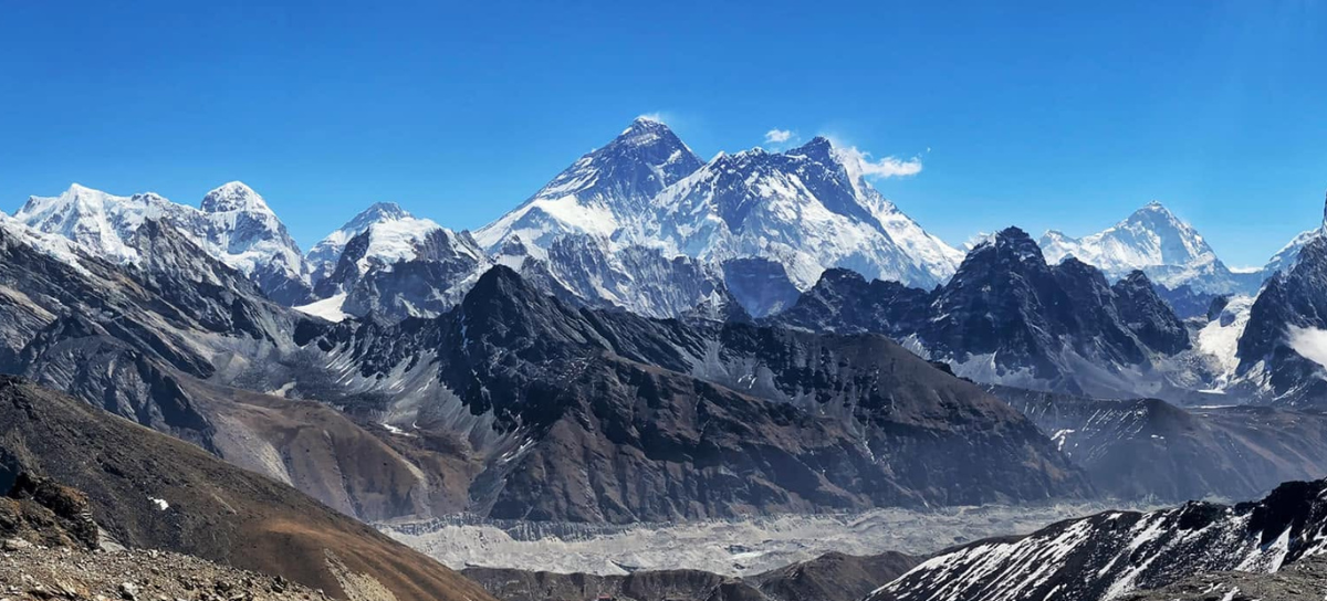
If you have ever traced your finger across a world map looking for the “roof of the world,” you already know the general direction to look somewhere in Asia, somewhere cold, somewhere impossibly high. But the real answer to “where is Mount Everest located” is more interesting than a single dot on a map. It’s a story about two countries, one mountain, and a summit so tall it technically belongs to both nations at once.
In South Asia, Mount Everest is located in the middle part of the Himalayan mountain range, on the border between Nepal and China. The southern part of the mountain is in the Solukhumbu district of Nepal while the northern part is in Tibet, which is an autonomous region under the control of China. The peak itself is at the highest point on Earth, directly on the international boundary line, and neither country can claim the peak exclusively to themselves. That’s just one reason why the location of Everest is unusual. The majority of the most popular mountains are solidly in one country. The only thing is that Everest is part of two.
Pinpointing Mount Everest on the Map: Coordinates and Region
For anyone who wants the precise geographic data, here’s where Everest sits on a global grid:
- Latitude: approximately 27.98° North
- Longitude: approximately 86.93° East
- Continent: Asia
- Mountain system: The Himalayas
- Sub-range: Mahalangur Himal, a subrange stretching roughly 80 kilometers long and 65 kilometers wide, covering about 5,200 square kilometers along the Nepal–China border
- Nearest major city (Nepal side): Kathmandu, roughly 140 kilometers to the southwest
- Nearest major city (China side): Shigatse (Xigazê), in the Tibet Autonomous Region
Two Countries, One Mountain: How the Border Works
On the Nepal side, Everest rises within Sagarmatha National Park, located in the Solukhumbu district of Koshi Province in northeastern Nepal. This park is a UNESCO World Heritage Site, home to Sherpa villages, dense forests at lower elevations, and the famous trekking trail that leads hikers to Everest Base Camp. Most climbers and trekkers who dream of seeing Everest up close approach from this southern route.
On the China side, the mountain stands within Tingri County, part of the Shigatse Prefecture in the Tibet Autonomous Region. This northern flank is protected as the Qomolangma National Nature Preserve. The Tibetan approach is quieter and less frequently visited by trekkers, though it offers its own base camp and equally dramatic views across the high plateau.
Why Everest Has Three Different Names
Everest is situated in the border region between two cultures and three names, which is why it’s not referred to as “Everest” in all places. The names you will hear will vary from person to person, depending on who you ask, and referring to the place and people surrounding the mountain.
It is called Sagarmatha among Nepalese, which translates as “Forehead of the Sky” or “Head of the Sky Touching the Heavens. The name is given to this mountain because of the longstanding respect that Nepalis and Sherpa people have shown for the mountain.
Chomolungma or Qomolangma, the Tibetan name, which is usually translated as “Holy Mother” or “Goddess Mother of the world”. It’s a continuation of centuries of Tibetan Buddhist tradition, where the mountain is regarded a sacred place.
The British name was added quite late, after the surveyors had given it the name of Everest and this name is the most widely used one today.
These three names do not mean that the mountain is moving; they are given because the mountain is located between two worlds of culture and politics.
The Himalayas: Everest’s Home Mountain Range
Looking a little further away, Everest is not a solitary mountain. It is the highest of the great Himalayan range that stretches from one country to another in the north of the Indian subcontinent, touching or bordering Nepal, China, India, Bhutan and Pakistan.
There are countless variations of Everest within this, a smaller collection known as the Mahalangur Himal, or even the “Everest massif” as some might deem it, as it also has several other giants of the mountaineering world:
- Lhotse (8,516 m): the fourth-highest mountain on Earth, directly connected to Everest by a shared ridge
- Nuptse (7,861 m): forming part of the same massif, just southwest of Everest

- Makalu (8,485 m): the fifth-highest peak globally, roughly 19 kilometers to the southeast
- Cho Oyu (8,188 m): the sixth-highest peak, sitting further west along the same border
- Ama Dablam (6,812 m): smaller in height but famous for its striking, dramatic shape
In other words, Everest’s location places it in the single most extreme high-altitude terrain anywhere on the planet. Four of the world’s six tallest mountains sit within a short distance of one another here.
Due to its location, it is an expedition to get to Everest, as there are no roads to the base camps and no easy way around the terrain. Most visitors fly from Kathmandu to the small mountain airstrip at Lukla, and then trek for about 10 days or so through Sherpa villages, suspension bridges, and thinner and thinner air, to finally reach EBC, which is located at about 5,364m above sea level.

Taking the road from the Tibetan side is also a longer trip but less strenuous, with passengers driving to the northern base camp with a flight to Lhasa. Both are at about the same elevation, looking at the same mountain, but from two sides of the same international boundary.
Quick Facts Recap
- Location: Border of Nepal and China (Tibet Autonomous Region), in the Himalayas, South Asia
- Coordinates: Approximately 27.98°N, 86.93°E
- Elevation: 8,848.86 meters above sea level, according to the latest joint Nepal-China survey
- Nepal-side district: Solukhumbu, within Sagarmatha National Park
- China-side county: Tingri, within the Tibet Autonomous Region
- Mountain range: The Himalayas, specifically the Mahalangur Himal subrange
- Names: Everest (English), Sagarmatha (Nepali), Chomolungma (Tibetan)
Both. The mountain sits directly on the Nepal-China border, with its southern slope in Nepal and its northern slope in Tibet, China. The summit marks the exact boundary line.
Neither country holds it exclusively. The peak lies precisely on the international border, so it’s considered shared territory between Nepal and China.
Not directly from the city itself, though short scenic flights from Kathmandu offer close-up aerial views of the mountain, and it’s occasionally visible from certain elevated points on a clear day.
Because its location bridges two distinct nations and cultures, Nepal and Tibet, each with its own language and spiritual traditions, plus the English name added later by British surveyors.
Yes. Ongoing tectonic movement between the Indian and Eurasian plates continues to push the Himalayas, and Everest along with them, slightly higher over time.